|
|
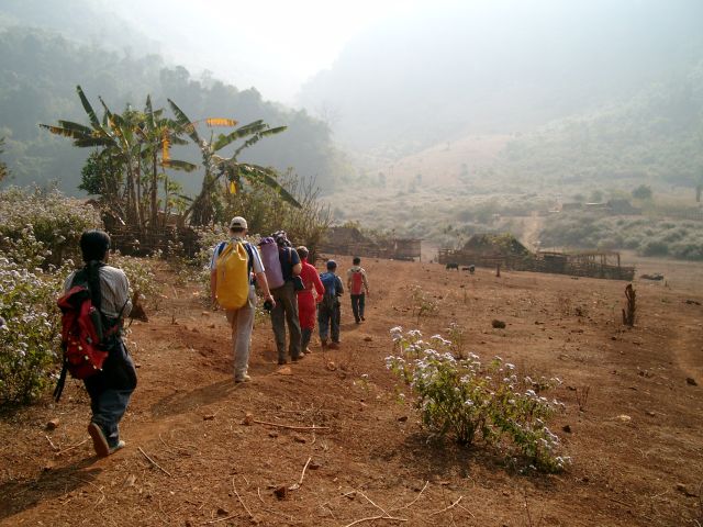
Northern Lao - European |
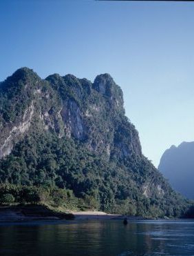
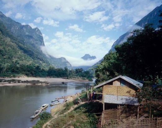
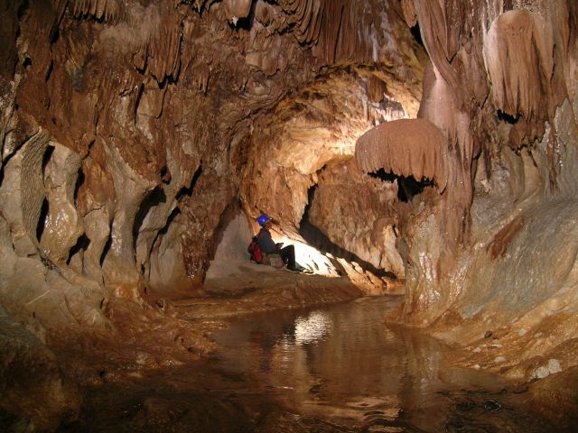
Laos 2002 Expedition to Muang Ngoy and Luang PrabangExpedition time: 16. - 30. December 2002The purpose of this small scale expedition was to check the potential for caves around Muang Ngoy and Luang Prabang and to establish contacts for further full-scale expeditions. This goals were achieved by exploring 22 easy accessible caves and the survey of 1.85 km. The Nam Ou Valley around Muang Ngoy Nua The investigated area is crossed by the wide Nam Ou river from the NE to the SW. Where the national road no. 1 crosses the river, the village of Nong Khiaw is situated. The small district town is a transfer point where people arrive by car or bus and continue to travel up- or downstream on the Nam Ou by boat. These limestone areas were first investigated by the 2000 Dutch expedition. About 14 km upstream (north) of the town of Nong Khiaw the Nam Ou river crosses an approximately 20 km long and 15 km wide area of large limestone massifs that summit at 700 – 1,500 m and that are covered with a dense monsoon rain forest. The Nam Ou partly has created an extremely scenic gorge with breathtaking cliffs up to 600 m high. The village of Ngoy Nua (“Village of the small peninsula”) is situated right in the middle of the Nam Ou gorge where the tributary creek of Nam Ngoy coming from the East joins the Nam Ou. Ngoy Nua is accessible by a 1 hour long boat trip from Nong Khiaw only. The longest cave along the gorge is the Tham Kham / Pageo (Holy image cave / Middle cave). The cave is reached in 30 minutes by foot from Ngoy Nua village along the creek Ngoy. The Tham Khan cave (520 m) has a wet lower entrance and a upper dry entrance. A sump is reached after about 200 m that certainly connects to Tham Pageo. This sump was free-dived for about 10 meters and two air-filled chambers were reached. However, no connection to Tham Pageo was made. UXO Laos (the regional explosives clearance project) has removed explosives from the cave. Traces can still be seen in Tham Kham. The entrance to Tham Pageo (1,550 m) opens immediately east of the Tham Khan resurgence. The entrance and the subsequent 100 meters of phreatic passage are pretty low with less than one meter and filled by mud. Later the cave becomes walkable and two crawls and a duck have to be passed until the cave divides into an East/Northeast and West section. The later one ends in a sump that connects to Tham Khan. The East/Northeast section of Tham Pageo continues for another 500 m until it ends abruptly. The caves so far known along the Nam Ou can be subdivided in two groups: a.) Active river caves like the Tham Khan/Pageo and the Tham Doun’s. These caves are flooded during the Monsoon. b.) Fossil caves that are situated about 50-150 m above the river of Nam Ou. These caves often have a rich calcite decoration and sometimes high contents of CO2. The average length is about 100-200 m. It has to be noted that during the expeditions caves with easy access mainly near the river were investigated exclusively. The upper cliffs and tops of the enormous karst plateaus still remain virtually untouched and a full-scale expedition will require exhaustive ”jungle-bashing” in steep terrain. Luang Prabang Area The second shorter part of the expedition focused on the area around Luang Prabang. The limestone mountains are easily recognised when descending by plane into Luang Prabang airport. Luang Prabang is with 20.000 inhabitants the second biggest city after the capital Vientane. It was the centre of Laos in 1353 at this time called Lan Xang which means land of the million elephants under a white parasol. It has many historic temples from this time and is one of the tourist highlights in Southeast Asia. A few caves were surveyed 6 km south of Luang Prabang at the river banks of the Mekong. These were the caves Tham Din and Tham Tatkeh which can be sorted into the scheme of fossil caves higher in the hills. |