| Laos 2012 Expedition
Expedition Laos: 15. January - 5. February 2012
Reece Myanmar: 27. January - 10. February 2012 |
 EuroSpeleo FSE EuroSpeleo FSE
|

NSS Exploration |
|
Eastern Area: |
 Michael Laumanns (coordinator), Carsten Ebenau
 Dimitry Bogushev, Irina Ermakova
|
|
Northern Area and Myanmar: |
 Joerg Dreybrodt
(coordinator),
Helmut Steiner
 David
Eskes
 Matt Oliphant,
Nancy Pistole
 Urs Etter, Manuel Borruat, Aline Daenzer
 Alessio Romeo
 |
The 2012 expedition consists of two independent expedition teams
focusing on two areas. One team explores the Luang Nam Tha province
and
Luang Prabang province in the north while
the other team visits Houaphan province in the east. A reece
to Myanmar is done after Laos in order to extend the activities of the
project into a bordering country.
Northern Team:
Two areas have been visited that are familar from the first
expeditions of the project in 2002 and 2005. Since then the
infrastructure has improved and new areas are accessible. The first week
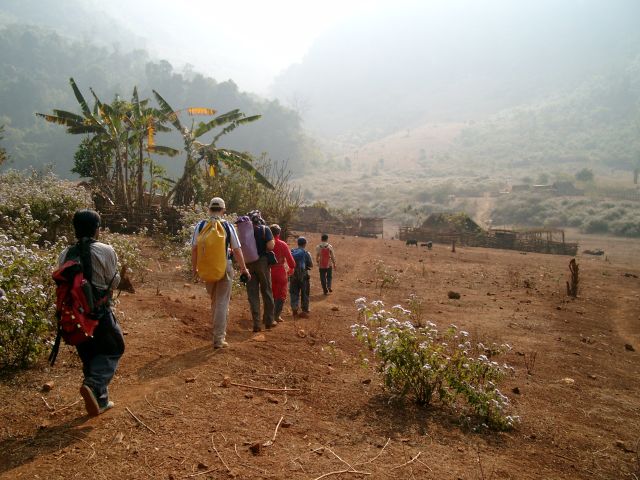
of the expedition was spent in Vieng Phouka district. The area north of
the town was checked during a two day jungle trek and several river and
fossil caves found. Furthermore areas close to Bang Eng and Ban Mai were
revisited. New river caves of 200-300 m length were surveyed. The
villages along the new road heading north to Muang Long were checked for
caves. Though the hills look very interesting with bare limestone
cliffs, caves similar to the several km long Tham Nam Eng are not found.
We heard of more caves to the east near Ban Nam Fa which might be worth
to visit when passing by.
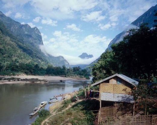
The base camp for the second week was in Nong Khiaw district. The
tourism office remembered the Dutch expedition from 2000 and supported
us with permission and guide. The first day a cave known since
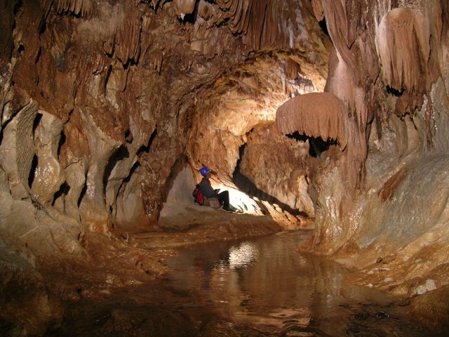
only few years was shown to us up river from Muang Ngoy. It has a
beautiful upper fossil passage and an active river which is reached
after a descent of 20 m. The cave called Doun Mai was visited for
three days to survey while one day was spent to check for caves down
river on the Nam Ou. The village of Ban Houaykhou is surrounded by
step cliffs. Surprisingly only short fossil caves were found.
The Myanmar reece proofed successful. We were allowed to visit an
area that is closed for foreigners since more than 10 years The Pinlaung
district hosts in one ridge several large chambers of about 80 m length,
60 m width and 35m height which have a depth potential below -100 m. The
Mai Lone Kho is now the deepest cave in Myanmar with -160m vertical
extension.
Eastern Team:
This team targeted Houaphan province,
which was visited before by the Project in 2007, 2008, and 2010. The
purpose of the investigations was to check out the cave potential in the
karst mountains along the main road from Vieng Xai towards Na Meo (Viengxai
district) as well as in the surroundings of the district capitol of
Xamtai. The first goal was achieved by surveying 40 new caves.
Generally, the
karst between Nam Seua and Na Meo is located in a narrow synclinal
structure approximately 3-5 km wide with the limestone hills increasing
in size from west to east. The surrounding mountains are higher and
mainly consist of schist. Cave development was phreatic in the
beginning. Especially the canyon-like passages in the caves around Ban
Siang Luang, Ban Nam On and Ban Khang Muang that often have anastomotic
tubes in the roof. In a later phase these tubes incised and keyhole-like
cross-sections were formed. This most likely coincides with a general
tectonic uplift of the area. In Tham Han cracks in columns and
stalagmites show these tectonic movements. Longer river caves only exist
up to the road pass east of Ban Khang Muang - further east only smaller
fossil caves were found. Unfortunately, it became apparent
that the karst in Xamtai district is quite difficult to reach. The
district government cannot provide clean water and electricity to the
villages further northwest of Xamtai city and has started a program to
resettle the villagers to other places. Consequently, the karst,
supposed to be about 25-30 km northwest of Xamtai city, is depleted of
settlements where assistance for a surveying team can be provided. As
these logistics were impossible during the 2012 trip a closer
investigation of the karst area northeast of Xamtai was waived.
A positive surprise on the very last
day of the 2012 expedition was a brief look into an area about 25 km
north of Sam Neua in Sam Neua district. Here, near the villages of Ban
Nam Koup and Ban Na Seng, a couple of supposed sinkholes and resurgences
were located by Helmut Steiner on topographical maps. This assumption
proved to be correct and the villagers, who belong to the Thai Deng
minority, confirmed a through cave (Tham Nam Oogh) stretching for about
2-3 km between the sinkhole close to Ban Na Seng and the large
resurgence cave, which can be reached by a 2 km walk through a scenic
tower karst landscape from the village. The resurgence cave was
investigated for about 200 m. The stream passage is about 15 m wide and
20 m high and has rich calcite decoration. The cave also has an
extensive fossil level. Consequently, a cave system possibly 4-5 km in
length is suggested near Ban Na Seng. The villagers also indicated the
existence of 2-3 other caves in the surroundings, including Tham Loum
(Wind Cave). The neighbouring village (Ban Nam Koup) has a large through cave just
across the paddy fields, which is about 100 m long. An underground river
flows through the cave. Along the way back to Sam Neua a couple of other
karst outcrops were spotted and inquiries in the (Hmong) villages
confirmed 3 small caves in Ban Long Oued and three stream caves along
the same river in Ban Pa Char. The latter caves were not entered by the
locals who reported one of these caves to be long. Consequently,
exploration of these karst areas can be best made by day-trips from Sam
Neua. If a permit for cave exploration
in this area can be obtained from the provincial authorities, a future
expedition is highly recommended.
We acknowledge the support of the FSE and NSS.
|
